
Dev Log #013 / Farm Forge
Farm Forge: A New Direction, and Real-World Terrain in Unreal
Farm Forge is now an independent, AI-led world studio built on Unreal Engine, with A.U.R.O.R.A. as the first point of contact. This week also produced the first real-world terrain pipeline: real elevation, real roads and rule-placed trees, built into an explorable Unreal scene.
A clearer direction
On 26 October we set Farm Forge's direction: an independent world studio built on Unreal Engine, where the first interaction is a conversation. You describe the world you want, A.U.R.O.R.A. turns it into a structured plan you can review, and after you approve it a real, editable Unreal world is built. You can then ask for changes in plain English, inspect them, undo them and save.
Farm Forge will be game-neutral. Our personal map-making tools for existing games are being kept separate from the product, so Farm Forge itself carries no game-specific code. RealityScan, Blender, ArmorPaint, OpenUSD and NVIDIA technology form the tool chain, added one at a time with licence checks for every asset.
Real-world terrain, built in Unreal
- An 8 km heightmap from the USGS 3DEP elevation programme, at 2 m per pixel.
- Roads and water from OpenStreetMap.
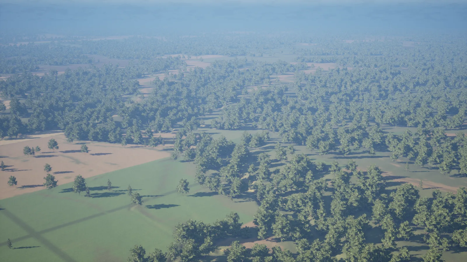
- Trees placed by simple ecological rules: cottonwoods along water, conifers on north-facing slopes. The test tile carries around 20,000 of them.
- A ground-colour layer, then an automated scene build, still renders, a flyover video and a walk-around explorer.
Those are the steps of the first concrete piece: a site pipeline that turns a real place into an Unreal scene, using only public and openly licensed data.
A useful mistake
The image above comes from the first complete run of that pipeline. It shows a test tile, not Madison. While preparing it, "MO" was read as Missouri instead of Montana, so the first tile was built in the wrong state. The pipeline did its job perfectly, which is exactly why the slip mattered: it was caught by checking the place, not the process.
The data for Madison Valley, around Ennis in Madison County, Montana, is now prepared: terrain, 518 roads, water and around 20,000 trees. The first Montana build is next. Madison is TW Farms' proving ground, where new tools are tested in a real world before they reach anyone else.
What comes next
Next we prove the core loop: A.U.R.O.R.A. creates a small world from one request, looks at the real viewport, makes a change, undoes it, saves, and reopens it exactly as it was. Then we repeat it with a second, genuinely different brief. Only when that loop works reliably does Farm Forge move on to the full creator experience.
Map data © OpenStreetMap contributors (ODbL). Elevation: USGS 3DEP (public domain).
Describe a world, approve the plan, and watch a real Unreal scene open: not a screenshot, not a mock-up, a world you can walk into and change.